Monday, May 31, 2010

Cycling Through the Badlands

The ride was hilly, but the Badlands were spectacular. We saw not only incredible land formations, but also herds of buffalo and horses roaming close to the road. In our 60 mile ride, the only human-made structures we saw were oil wells and oil storage facilities.
Note: we had thought that the term "Badlands" referred to the fact the outlaws and other "bad guys" hung out there. Instead, it's a term that means "a barren area in which soft rock strata are eroded into varied, fantastic forms". They occur not only in the United States, but also in New Zealand and other countries.

The Badlands

Another scene in the Badlands

A herd of buffalo beside the road


A herd of horses (click to see video)

Our lunch stop (no restaurants today)

Sunday, May 30, 2010

Leaving Route 2 after 750 Miles

     We've been through a lot together, Route 2, but now it's time to split. In the weeks we've been together (both of them), we've had good times and bad. We've seen a remarkable variety of scenery together, including towering snow-covered peaks, mountain passes, flat plains, and rolling hills. Together we've visited national parks and Indian reservations. We've traveled together through vast farms, large oilfields, and huge empty fields. We've experienced rain, snow, hail, cold, and high winds with you, and stayed in accommodations ranging from splendid B&B's, to decent motels, to a grungy cabin.
     We're now ready to turn from our long-term relationship with you to a series of one-day stands, starting with Route 85 on Sunday, then Route 200 on Monday, then others. We wish you well.
  
     And now for an interesting fact about North Dakota: among all states in the US, it has the lowest percentage of people who profess to no religion and the most churches per capita.

We hope you don't take it too badly, Route 2, but we're choosing Route 85


Lots of wide open, empty spaces in northwestern North Dakota


A roadside billboard

Saturday, May 29, 2010

We Entered North Dakota and Struck Oil

    After spending 13 days in Montana and cycling nearly 700 miles in the state, which is the fourth largest in the US, we crossed the border into North Dakota on Saturday with the wind behind us and no rain. The terrain so far looks like that of central and eastern Montana -- plains and rolling hills -- but a striking feature is the appearance of numerous oil rigs and oil drilling sites. We learned that western North Dakota has large oil reserves and an ongoing oil boom, and we read about farmers who became instant millionaires when oil was found on their land.


Flooding in Montana. No surprise, since we've ridden through rain for the past few days.

Our last sight in Montana, before crossing into North Dakota. Casinos are everywhere in Montana, to our horror.

Entering North Dakota


An oil rig


Drilling for more oil

Friday, May 28, 2010

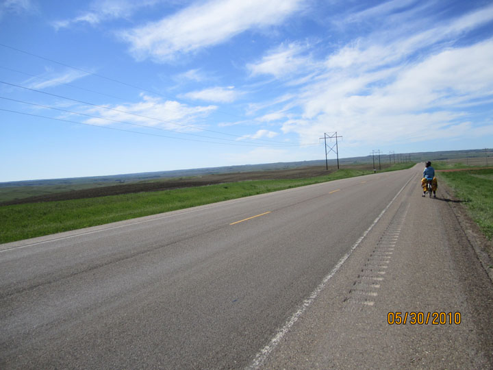
     Friday was a cold, wet, and windy day for our ride (again). It wasn't as bad as that sounds, however, because we dressed for the rain and cold, and the wind was from the north so it wasn't into our faces (it just hit the left sides of our bodies as we cycled eastward). The weather in northern Montana has been unusually cold and rainy, with the news reports full of flood and wind warnings, and flooded fields and overflowing streams all around us. But we're having a great time, and it's very satisfying to be faced with challenges and overcome them.
     We've spent the bulk of the past three days on the Fort Peck Indian Reservation, including most of our Wednesday and Friday rides and a rest day Thursday in Wolf Point, a town in the reservation. We learned something about the reservation from the owner of a sports store in Wolf Point, who was born in Natick, Massachusetts and, after moving around a lot, moved to Wolf Point to "hunt, fish, and get away from people". The Native Americans (which means anyone who's at least one-quarter Native) are under the governance of the tribal rulers, while everyone else (like the sports store owner) is under the governance of the state of Montana and the Federal government. Only the non-Natives pay taxes to the state and federal government. Law enforcement is a complex mix, with tribal law enforcement for the Natives, separate law enforcement for the non-Natives, state highway patrol for everyone, and sheriffs for who knows. On our Friday ride, we saw all sorts of law enforcement vehicles drive by us.
     There is, unfortunately, plenty of evidence in what we saw and heard of serious societal problems affecting the Natives. We've heard lots of comments about serious alcohol and drug abuse, and were warned by several people about the danger of staying in any town other than Wolf Point. A headline in today's reservation newspaper talked about a "suicide emergency". Though most of what we saw outside the towns was open space (large flat fields, some cultivated, or rolling hills, some with cattle or horses), we also saw junk lots, sometimes huge ones, right by the side of the road or in front of broken down trailer homes.

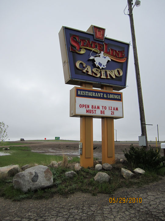
Sitting by the slot machines for our Friday morning break

Our Friday lunch stop, combining a restaurant, laundromat, video rentals, and (of course) slot machines

Sharing the one table at our lunch stop

Part of a vast junk heap beside the road in Fort Peck Indian Reservation

Wednesday, May 26, 2010

Changing Our Schedule Based on the Wind

     The winds on the plains of northern Montana are powerful, and have led to a minor modification in our schedule. After our "terrible, horrible, ..." day biking into an easterly wind on Monday, the wind shifted to westerly on Tuesday, so that we had a pleasant 72 mile ride from Malta to Glasgow with the wind behind us. Our plans, and hotel reservations, called for a rest day in Glasgow followed by a 50 mile ride to Wolf Point on Thursday. However, the weather forecast called for a moderate easterly wind (8-13 mph) on Wednesday and a very strong easterly wind (20-25 mph) on Thursday, so we chose to ride from Glasgow to Wolf Point on Wednesday and shift our rest day to Thursday in Wolf Point.
     Most of our Wednesday ride was in the Fort Peck Indian Reservation, where the town of Wolf Point is located. Though in a reservation, the population of Wolf Point is approximately equally divided between Native Americans and whites. The town is quite pleasant and our hotel is very nice. For dinner we enjoyed the local fish, walleye, excellently prepared at the restaurant in our hotel.
     We got special news at our morning break today: Nicky (Carol's daughter) got accepted into the University of Vermont Medical School! Although she has already been accepted to other schools, she was hoping to get into UVM based on her positive feelings about the school at the time of her interview in December.


The very strong wind against us (click to view)

Entering the Fort Peck Reservation

Scenes from our late morning break on Wednesday:

Down on the side of a drainage ditch, to escape the wind


Recovering from riding into the wind


Pretty cool with shades and doo-rag

Monday, May 24, 2010

A "Terrible, Horrible, No Good, Very Bad Day"

     Our trip has been incredibly great so far, but we can do nothing but complain about Monday's ride from Chinook, MT to Malta, MT. All aspects of the ride were miserable, so the title of a Judith Viorst children's book fits perfectly.
     The worst aspect of the day was the wind, which was strong and blew directly into us all day. Sunday's ride of 83 miles with the wind was a breeze compared to today's ride of 68 miles into a stiff wind (bad pun, but accurate statement). The only way we were able to make it to our destination was to use the technique of "drafting", whereby one person closely behind the other. The rider who's drafting (the one in back) not only is partially protected from the wind by the lead rider, but also is pulled forward into the low pressure area in the turbulent wake behind the lead rider. For the entire ride today, we took turns drafting, switching roles every mile. When the drafting rider saw the next mile signpost coming up, he/she groaned with the realization that the luxury of drafting was about to end for the next mile.
    It was also cold, with a high temperature of 56 degrees, and rained most of the day, at times heavily. Furthermore, there were almost no places to stop to go indoors and get a break from the wind, cold, and rain. This was, in part, due to the fact that much of the ride was through the Fort Belknap Indian Reservation, in which the only building on the road was a large casino right as we entered the reservation.
     Since we're on a roll with our complaining, we can add that the scenery was dreary and that Peter scraped his knee and tore a hole in his rain pants (but nothing that a little duct tape won't fix).
     When we arrived at our destination, we debated whether this was the worst biking day we've ever had and decided that it probably was.

Entering the reservation

The large casino near the entrance to the reservation (it's unfortunate that such a major component of revenue for some tribes derives from gambling, a vice that can ruin people's lives)

The best spot we could find for lunch (no reservations necessary). It was by a drainage ditch, low enough to be largely protected from the wind.

The lunch parking area (no valet parking available)

Sunday, May 23, 2010

Far and Fast

On Sunday, a cold and windy day, our route was 83 miles long, one of the longest days of our trip. Fortunately, the wind was strong and behind us, so we averaged over 16 mph, much faster than our usual speed of about 11 mph with baggage. Even with a long lunch stop at a restaurant/casino (it seems as though everything in Montana is a something/casino), we made it to our destination town of Chinook by mid-afternoon (leaving plenty of time to work on the book we're revising).

Carol's skullcap is not worn for religious purposes, but because she's about to take off in 39 degree weather at 8 am in Chester, MT

A sad sight on route

Almost every day since we began our west-to-east ride, we see 10-20 freight trains, each at least a mile long. It's great to see such heavy use of this energy-efficient means of transporting goods (and it fits in well with the "green" nature of our trip).

Saturday, May 22, 2010

From the Windy Plains to a Jewel of a B&B

     On Friday and Saturday, we cycled from Cut Bank, MT to Chester, MT. Though we crossed the Continental Divide only a day earlier, ending a week of passing through forests and towering mountains capped with snow, the terrain is now remarkably different: flat and treeless. Another striking feature is the howling wind, which ranges from moderate to strong. When it's behind us, we fly along at over 20 mph, but when it comes in from the side it's a struggle to keep going in a straight line. Fortunately, we haven't yet experienced a headwind, which would make travelling very difficult.
     On Saturday, we arrived in Chester and checked in at the Great Northern B&B. What a great place it is! We have our own little "home", adjacent to the owners' house, with a living room, kitchen, bedroom, and bathroom equipped with a steam shower (combination of steambath & shower). The owners' main business is music: Philip Aaberg is an accomplished pianist who performs around the world, a Harvard graduate who "weaves strains of blues and bluegrass as well as rock and new music throughout his melodic tapestries" [from his label's website: sweetgrassmusic.com]. Together with his wife, Patty, he runs Sweetgrass Music, which has a recording studio in their home and an office a few blocks away.

Taking advantage of the howling winds (these were part of a huge wind farm, consisting of hundreds of windmills)

Long, flat road -- quite a difference from the mountains of two days earlier


Great Northern B&B -- our "home" is on the right and beside it is the owners' home with the recording studio in the round metal structure

The Sweetgrass Music office

Thursday, May 20, 2010

Crossing the Continental Divide

     We set off Thursday morning, on a cold, rainy, windy day for our 1500 foot ascent up to the Continental Divide, crossing it at 11 am at Marias Pass (5216 feet above sea level). When we left our hotel, little did we know that we would be exposed to brief periods of snowfall at the high altitudes, and winds as high as 45 mph in the afternoon. Fortunately, the wind was with us almost all day, but when we were caught in cross-winds it was a challenge to keep our bikes going in a straight line.
     Thirteen miles after crossing the Divide, we passed the eastern boundary of Glacier National Park and entered Blackfeet Indian Reservation. The change in scenery was sudden and remarkable: for the past week, we've been cycling through monstrous, snow-covered peaks, but within 25 miles of crossing the Continental Divide the mountains had melted away and we were surrounded by fairly flat ranchland.
     The lodging we had reserved for Thursday night was a motel in Browning, MT, a town within the reservation, but on Thursday morning we received several warnings that Browning was a dangerous, high-crime town, where we should not stay. In part because of these warnings, and also because we were travelling at high speeds due to the strong tailwind, we continued on through Browning, cycling an extra 30 miles (for a total of 76 miles for the day, making tomorrow's ride very short). We ended at a Super 8 Motel in Cut Bank, MT, just outside the reservation.

Setting out with gear for rain and cold: rain jacket and pants, waterproof gloves, waterproof fleece-lined shoe covers, rain glasses (tinted to make the weather look artificially pleasant)


We made it up to the Continental Divide!

There's snow beside the road at Marias Pass


Entering the reservation

Ranchland about 25 miles east of the Continental Divide

Wednesday, May 19, 2010

"Real" Tourists: Sightseeing the Motorized Way

Wednesday was one of our rest days, planned to occur once every 7-8 days during our trip, at an interesting spot whenever possible. This rest day was at Glacier National Park, a great place to spend time sightseeing. We did it like real tourists, renting a car and driving in and beside the park, and taking a helicopter ride over the park.
Our first day driving in a month. What a great invention: it goes really fast, even up hills.

About to go on the helicopter tour

Left: View of helicopter & scenery (summertime)
Right: Our view from the helicopter

More views from our helicopter:


Here's a spectacular waterfall, seen during our car ride beside the park (click to play video):


Tuesday, May 18, 2010

Scenes From Northwestern Montana

On Sunday-Tuesday (May 16-18), we cycled 150 miles from Libby, MT to Essex, MT. Our ride was interrupted by problems with Peter's back wheel, requiring a 4-hour stop for repairs at a superb bike shop in Kalispell.

We rode along Route 2, with long stretches that were nearly empty.  The lack of traffic was great, but the downside was that there were few places to stop for a snack or lunch, especially on Sunday. The route was characterized by astounding natural beauty. What humans have brought to the area is more mixed.

Snow-covered peaks in the distance (on Sunday)


 Snow-covered peaks close by (on Tuesday)


A pristine lake (Middle Thompson Lake)


A fast-running stream, swollen by melting snow high above


A picturesque scene of cattle grazing on a partially wooded field


Our morning break on Sunday


Our lunch stop on Sunday


A sign outside a bar/restaurant


A bulletin board announcing far right-wing events


One of several roadside billboards we saw warning about the horrors of meth


Our lodging on Sunday night, with the basics only: bed, bathroom,
mouse droppings, strong dog smell; no phone, cell service, or internet


The marvelous and historic Izaak Walton Hotel,
where we're staying on Tuesday and Wednesday