Sunday, July 11, 2010

Our Adventure is Over :(

     We're writing this final blog entry from our home in Boston. We had a wonderful time, and are feeling great about having succeeded in our goal of making it across the country on our own power (though we were briefly tempted to hitchhike, instead of walk, up a few very steep hills in the Alleghany Mountains in the intense heat a few days ago).
     On Friday evening, we gave a talk about our trip, with a Powerpoint presentation, at Kendal, Carol's father's retirement community. The audience of about 100 people listened intently and showed their interest by asking many follow-up questions. The presentation can be viewed online at http://tinyurl.com/PD-CB-BikeTrip.
      Saturday's ride, the last of our trip, was a short 33-mile route in pouring rain, ending in Philadelphia at the apartment of Nicky Benson (Carol's daughter). Since we were still in our high-caloric-intake mode, we went to lunch with Nicky and her boyfriend Nathan Miller at Max Brenner's, an eating establishment that specializes in chocolate.
      We have one day to get back into "regular" mode: dressing in decent clothes, going to work, limiting our intake of "junk" food, etc. We'll miss our daily bike rides. Our big challenge now is to figure out what our next big adventure will be. We're mulling over a few options. Stay tuned!

Our talk at Kendal


The lecture room filling up with interested listeners


Arriving at our final cycling destination in Philadelphia (very sad!)


A last fling at high-caloric meals


Arriving home in Boston

Friday, July 9, 2010

Pennsylvania Dutch Country

     Our rides on Thursday and Friday were no longer in the steep, difficult Alleghany Mountains, though they had numerous small-to-medium ups and downs. On Thursday, we rode 58 miles from Fort Littleton to Lancaster, PA, leaving at sunrise to beat the heat. We arrived at our destination -- the Lancaster Marriott -- at noon, and were pleasantly surprised to find Carol's father Martin Beer and aunt Hilda Grauman waiting for us in the lobby. They had driven the 40 miles from Kendal, the retirement community in which they live, to see us and have lunch with us.
     Friday's ride was a fascinating 43-mile route from Lancaster to Kendal through Pennsylvania Dutch country, an area with a sizable Amish population and numerous Amish farms. The Amish are a group who practice simple living and avoid most modern conveniences, such as electricity from power lines, in-house telephones, and motorized vehicles such as cars and tractors. They originated in Germany and German-speaking parts of Switzerland, and the term "Dutch" is probably a misnomer based on a misspelling/mispronunciation of "Deutsch" (the German word for "German").


At lunch on Thursday with Martin Beer and Hilda Grauman in Lancaster, PA


Carol passing an Amish horse & buggy


An Amish farm with a buggy in the driveway

The next three pictures are from our wonderful ride from Lancaster to Kendal, with Intercourse on route:


Wednesday, July 7, 2010

Leaving at Sunrise to Beat the Heat

Wednesday was the last of a four-day stretch that was by far the most difficult of our trip, with more climbing, steeper climbing, and hotter weather than anything that we had previously experienced. Throughout the trip, we've made decisions each evening about the next day's ride based on the weather forecast. The forecast high temperature was 97 degrees for Tuesday and 98 degrees for Wednesday, with a high temperature advisory in effect (i.e., advising people to be "couch potatoes" in an air-conditioned room, avoiding strenuous outdoor activity). We weren't about to comply with the advisory, but we did start our ride at sunrise (just before 6 am) on Tuesday and Wednesday to minimize the time in the extreme heat. That resulted in temperatures in the 70's until 9 am, in the 80's from 9-11 am, and in the 90's from 11 am until we arrived at our destination at 12:30 pm each of these two days.

Both days had long, steep climbs in the Alleghany mountains, especially on Wednesday morning when we had a 1000 foot ascent that was so steep that we had to walk our bikes up more than half the climb. Steep hills have road signs indicating the percent grade, as a warning to trucks, so we've learned that we can peddle up with our 25 pounds of baggage if the grade is no more than 9-10%, but have to walk if it's more than that.

When we arrived at our Wednesday destination of Gettysburg, PA, we went right to the Gettsyburg Hotel, located on the town's central square, where we had reserved a room months ago. On learning that the rooms had wired, but no wireless, internet (which would mean that we couldn't both be on the internet at the same time), we immediately cancelled our reservation and checked into another hotel in town that had in-room wireless internet. We've learned on our trip that wireless internet has become virtually standard at all lodging places, even small motels in out-of-the-way places.

The clock as we were departing on Tuesday morning


Sunrise during our Wednesday ride


Riding through the Alleghany Mountains


12% grade, too steep for us to cycle (& far steeper than any roads we encountered before reaching the Alleghany Mountains of Pennsylvania)


Walking up the 12% grade


Sweating profusely after a steep climb


A thermometer in the shade in Gettysburg, reading 102 degrees at 1 pm (shortly after the end of our day's ride)


Monday, July 5, 2010

Another Hilly, Hot Day

     Monday's ride, a 54-mile ride from Ligonier to Bedford, PA, began with a climb from 1200 to 2700 feet in the first 10 miles, then went downhill back to 1200 feet, then climbed back up to 2700 feet again. That's two 1500 foot climbs in one day, as well as numerous smaller ups and downs all day, for a total ascent of 5000 feet today (the same as yesterday, and far higher than any other day on our trip).
     Adding to the day's discomfort was great heat, with the temperature reaching 93 degrees. Hill-climbing and high temperatures are a bad combination. Furthermore, we encountered yet another unpassable road due to bridge construction, which added distance and time.

Monday's route profile, showing the two 1500 foot climbs and other ups & downs


The top of the first 1500 foot climb, at 9 am


The top of the second 1500 foot climb, at 1 pm


One of several unpassable road closures we've encountered in Pennsylvania

Sunday, July 4, 2010

The Hilliest Ride with the Steepest Climbs of our Trip So Far

     We knew all along that the four days out of Pittsburgh (Sunday-Wednesday July 4-7), in the Alleghany Mountains of Pennsylvania, were going to be the hilliest of the entire trip, with far more elevation gain per day than any of our days in the Rocky Mountains. While the Rocky Mountains are much higher (5200 feet at our highest point in the Rockies, compared to a maximum of 2900 feet in the Alleghanies), the roads through the Alleghanies have many more ups and downs, resulting in many more feet climbed per day.
     What we didn't know was that a number of factors would add to the difficulty:

1. Steepness: Four hills on Sunday were so steep that we had to walk our bikes (& baggage) up at least parts of them, including one stretch where we walked up about 500 feet. We now know that the next three days will include quite a bit more walking. Up until Sunday, we had never walked our bikes up a hill on the entire trip.

2. Very busy Highway 30: We had routed ourselves along Route 30 for much of Sunday-Wednesday, but it turns out to be a high-traffic road, ill-suited to cycling. When we modified our route to avoid Route 30, the route became considerably more hilly.

3. Heat: The temperature today reached 90, and it is predicted to be at least that high for the next several days.

Another factor that added to the difficulty on Sunday was road construction and closings at several points on our route, which forced us to re-route (adding miles and hills) and, on one occasion, to take a perilous crossings of a bridge under construction.

All in all, it's a very challenging period of our trip.

Walking the bike up a steep hill in the Alleghany Mountains


Carol's leg injury resulting from a perilous stretch where a road was closed for repairs

The next three images show a dangerous crossing of a bridge under construction:


Saturday, July 3, 2010

Mid-Course Correction on the Way to Pittsburgh

     On Friday, we crossed our last state line, from Ohio to Pennsylvania. The 54-mile route took us by a historic landmark set by the first geographer in the US in 1786 and past massive nuclear and coal-fired power plants.
     Our planned route was along the Ohio river, and we thought that it was going to be a lovely road.  However, the road got increasingly busy and by the time we were 30 miles from Pittsburgh it turned into a limited access, divided, 4-lane highway, making for unpleasant and somewhat perilous cycling. So we pulled off at a gas station on route, where Peter pulled out his computer and rerouted us on nicer back roads. The new route was quickly transferred to our GPS units, and we were off and riding again along a pleasant route.  Despite the delay, we made it to Pittsburgh for lunch.


The state line entering Pennsylvania from Ohio


A nuclear power plant along our route


A massive coal-fired power plant along the route


Ever flexible, Peter devised a new route into Pittsburgh on his computer. We then transferred the route to our handlebar GPS units and continued on our ride.


Crossing the bridge to downtown Pittsburgh

Friday, July 2, 2010

Balanced Diet (of Sorts) Powering Us Across America

Cycling burns plenty of calories, so one of the joys of our trip is that we get to (in fact, have to) eat a lot. Our version of a balanced diet is to try to eat "healthy" food for breakfast, lunch, and dinner, and "junk" food the rest of the day. Based on our energy levels, it seems to be working well. On top of that, each of us gets to satisfy our "sweet-tooth" by eating lots of cookies and candies at our breaks on route and after arriving at our destination each day.
     Our route was all pre-planned months in advance, down to the selection of every road across the country – mapped on computer and transferred to our handlebar GPS units. The one thing we couldn't plan for was road construction, which we encounter fairly frequently. Usually it's minor roadwork, but occasionally we come to a "Road Closed" sign. We always ignore these warnings and manage to get through, sometimes with a major effort, as per the pictures below from Thursday's ride from Canton, OH to East Liverpool, OH.


A break for a diet soda and junk food


Some of our candy and cookie choices


Peter's a caramel lover


Boldly (? foolishly) ignoring a "Road Closed" sign


Here's why the road was closed: a bridge under construction


A plank to get off the far end of the bridge


Carrying a bike so we could continue along our route

Wednesday, June 30, 2010

A Visit to the Pro Football Hall of Fame

     On Wednesday, we cycled 55 miles through lovely Amish farm country in Ohio, from Ashland to Canton. Helped by favorable winds, we arrived in Canton in plenty of time to have some minor bike repairs done and then to visit the Pro Football Hall of Fame. Canton has a special place in the history of professional football, as the American Professional Football Association, the predecessor of the National Football League, was founded there in 1920.
     We continue to be struck by how car-oriented and pedestrian-unfriendly the medium-sized towns are in Indiana and Ohio. We went to a restaurant about a half mile from our hotel, and without a car the only choices to get there were to bike on unbikable roads or walk on unwalkable roads. We chose the latter, walking beside a highway through weeds and dirt and crossing two multi-lane roads without benefit of pedestrian crossing lights.

An Amish farm near Ashland, Ohio


At the front entrance of the Pro Football Hall of Fame


The Hall of Fame building

Tuesday, June 29, 2010

The Historic Lincoln Highway

     Most of our ride on Tuesday, from Upper Sandusky to Ashland (both in Ohio) was on small, quiet roads through beautiful farmland. We're fortunate that many of the small roads in Ohio are paved, allowing us to get off the medium-sized roads that have formed the bulk of our cross-country trip.
     Our route through the last three states of our trip -- Indiana, Ohio, and Pennsylvania -- is on or close to the historic Lincoln Highway. It was the first cross-country highway, conceived in 1912 and formally dedicated in 1913 by auto enthusiasts and auto industry officials. It extended from Times Square in New York City to Lincoln Park in San Francisco, and was known as "The Main Street Across America". Information about the highway is available from the Lincoln Highway Association (www.lincolnhighwayassociation.org) and state chapters in the 12 states its traverses. Much of the eastern part of the Lincoln Highway today coincides with US Route 30.

Cycling on the Lincoln Highway


A plaque dedicated to the Lincoln Highway


On a picturesque country road in Ohio

A mid-morning break for snack, water, and (as pictured here) email

Monday, June 28, 2010

Highway Exits: The New Centers of Commerce in Small-Town Middle America

     When we traveled through Montana and the Dakotas earlier in our trip, the towns we stopped in were too small (~1000 people) to attract chain hotels & motels. Over the past couple of weeks in Minnesota, Wisconsin, Illinois, Indiana, & Ohio, we've generally been staying at chain hotels (Best Western, Comfort Inn, Microtel, Super 8, etc.) in larger towns of ~8000-20000 people. These are located not in the town centers, but 1-2 miles away at the nearest highway exit, together with chain stores (Walmart, KMart, ...) and chain restaurants (Macdonalds, Burger King, Arby's, Dairy Queen, ...). With the centers of commerce shifted to the highway exits, the downtowns are often shabby, with a lot of boarded up storefronts and no active hotels. Fortunately, most of the towns have at least one reasonable downtown restaurant, allowing us to avoid the unhealthy junk food found at the highway exits.
     Monday morning started at one highway exit hotel -- Microtel in Delphos, OH -- and ended in another -- Comfort Inn in Upper Sandusky, OH. The day began the way Sunday evening ended: with a power failure at our hotel, the result of a lightning strike right beside the hotel on Sunday evening. Once we left the hotel, however, the ride was a pleasant and fast one, helped by a friendly west wind.

Our starting point on Monday morning. The trucks outside were part of the effort to fix the power failure that began 12 hours earlier.


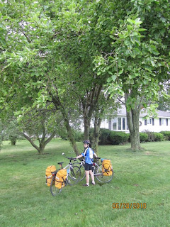
Ducking under a tree for protection from an early morning rain

Stuck at a railroad crossing when the train stopped moving


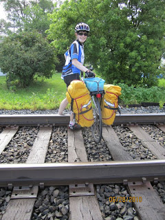
We went past the end of the train, crossed the tracks, walked our bikes through someone's back yard, and proceeded along our route


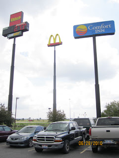
Arriving at our destination hotel, the Comfort Inn


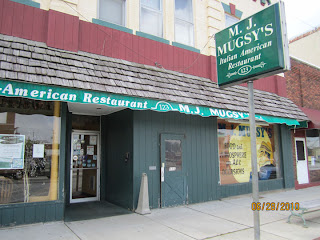
Fortunately, there was a decent restaurant for lunch and dinner in Upper Sandusky, OH